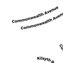
16951697 COMMONWEALTH AV
Owner Information
CHESAPEAKE REALTY LLC MASS LLC
17 WALNUT HILL RD
CHESTNUT HILL, MA 02467


Property Details
16951697 COMMONWEALTH AV is classified as a Apartments with More than Eight Units (Apt 7-30 units).
The primary structure on this property was built in 1920. There are 13,424ft2 of built area within this property. There is 10,068ft2 of residential/living space within this property.
16951697 COMMONWEALTH AV is valued at $3,029,200. The land is valued at $965,500 and the structures are valued at $2,063,700.
The most recent deed for 16951697 COMMONWEALTH AV is recorded at the local registrar in Book 74647, Page 2RL. 16951697 COMMONWEALTH AV was last sold on Wednesday, December 19, 2007 for $1.
Assessment data from fiscal year 2020.
Flood Data
According to the FEMA National Flood Hazard Layer, this property does not appear to be in a flood zone. It may also be in an area not yet reviewed. Nonetheless, confirm this information prior to taking any action.
To view the flood hazards around this property, create a FEMA "Firmette" Map of the area around 16951697 COMMONWEALTH AV.
Broadband Internet Providers
| Provider | Type | Bandwidth (mbps) | |
|---|---|---|---|
| Crown Castle Fiber | Fiber | 0 | 0 |
| RCN | Cable | 1000 | 20 |
| Starry, Inc. | Fixed Wireless | 200 | 200 |
| GCI Communication Corp. | Satellite | 0 | 0 |
| HughesNet | Satellite | 25 | 3 |
| VSAT Systems, LLC. | Satellite | 2 | 1 |
| Viasat Inc | Satellite | 100 | 3 |
| Verizon New England Inc. | DSL | 15 | 1 |
| Verizon New England Inc. | Fiber | 940 | 880 |
| Comcast | Cable | 1000 | 35 |
| RCN | Cable | 500 | 20 |
Broadband service provider data from December 2020.
Adjacent Properties
- 1691 COMMONWEALTH AV 19
Residential Condominium owned by EHRLICH RICHARD D ETAL - 1691 COMMONWEALTH AV 33
Residential Condominium owned by FOSTER JACK - 1691 COMMONWEALTH AV
Other, Open Space owned by ONE 691 COMMONWEALTH - 1691 COMMONWEALTH AV 1
Residential Condominium owned by HY LISA H - 1691 COMMONWEALTH AV 2
Residential Condominium owned by CAI RICHARD - 1691 COMMONWEALTH AV 3
Residential Condominium owned by CHENG CARLOS TS - 1691 COMMONWEALTH AV 4
Residential Condominium owned by NAGY KIM ROBIN - 1691 COMMONWEALTH AV 6
Residential Condominium owned by ALBERT ROBERT I TS - 1691 COMMONWEALTH AV 7
Residential Condominium owned by SCHMAHMANN DAVID R - 1691 COMMONWEALTH AV 8
Residential Condominium owned by LIU SHANG-SHENG - 1691 COMMONWEALTH AV 10
Residential Condominium owned by WANG ZHIGANG - 1691 COMMONWEALTH AV 11
Residential Condominium owned by KESNER JEFFREY A TS - 1691 COMMONWEALTH AV 13
Residential Condominium owned by WONG WILLIE - 1691 COMMONWEALTH AV 14
Residential Condominium owned by 1691 COMMONWEALTH AVENUE REALTY TRUST - 1691 COMMONWEALTH AV 15
Residential Condominium owned by HO REBECCA - 1691 COMMONWEALTH AV 16
Residential Condominium owned by DANILOV ROMAN - 1691 COMMONWEALTH AV 17
Residential Condominium owned by RIA REALTY LLC - 1691 COMMONWEALTH AV 18
Residential Condominium owned by KASPER PETER J - 1691 COMMONWEALTH AV 21
Residential Condominium owned by JANG KEN - 1691 COMMONWEALTH AV 22
Residential Condominium owned by LEE WAI CHEUNG - 1691 COMMONWEALTH AV 23
Residential Condominium owned by RIA REALTY LLC - 1691 COMMONWEALTH AV 25
Residential Condominium owned by DALY FAMILY TRUST - 1691 COMMONWEALTH AV 26
Residential Condominium owned by EHRLICH RICHARD D ETAL - 1691 COMMONWEALTH AV 27
Residential Condominium owned by PAVLOTSKY NELLI I - 1691 COMMONWEALTH AV 28
Residential Condominium owned by CUNNINGHAM LIAM J - 1691 COMMONWEALTH AV 31
Residential Condominium owned by SHUBOV ALEXANDER L - 1691 COMMONWEALTH AV 34
Residential Condominium owned by SCHMAHMANN DAVID R - 1691 COMMONWEALTH AV 5
Residential Condominium owned by KENNEY RAYMOND J III - 1691 COMMONWEALTH AV 20
Residential Condominium owned by JUNOWICZ ENRIQUE - 1691 COMMONWEALTH AV 12
Residential Condominium owned by RDE LLC - 1691 COMMONWEALTH AV 24
Residential Condominium owned by RIA REALTY LLC - 1691 COMMONWEALTH AV 30
Residential Condominium owned by LEE LILLIAN - 1691 COMMONWEALTH AV 32
Residential Condominium owned by IGNATIEV GEORGE - 1691 COMMONWEALTH AV 9
Residential Condominium owned by LIU YUMING - 1691 COMMONWEALTH AV 29
Residential Condominium owned by ZHU XIAOMEI